
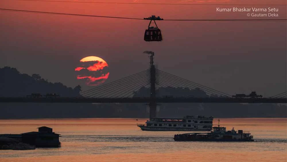
Ask anyone in Assam where they are from and the answer often comes with a river attached. Towns grew where rivers met, and many place names still record the meeting point with the word mukh, meaning mouth: Dihingmukh, Dikhowmukh, Jirimukh, Bharalumukh. The rivers decide where paddy grows, where floods come each year and where sand buries a field overnight.
A list of more than two hundred river names can feel overwhelming. It becomes much easier once you see that Assam has only two river systems.
The first is the Brahmaputra system. It drains the long Brahmaputra Valley, from Sadiya in the east to Dhubri in the west. Almost every river in the state, from the big Himalayan rivers to small streams in Karbi Anglong, ends up in the Brahmaputra.
The second is the Barak system in southern Assam, covering Cachar, Hailakandi and Sribhumi (formerly Karimganj) districts. The Barak flows on into Bangladesh, and its waters meet the Brahmaputra’s only there, far downstream.
The Barail range and the hills of Dima Hasao separate the two valleys.
This article follows the rivers in the order a geography teacher would draw them on a map. It starts with the Brahmaputra, then the rivers joining it from the north, from east to west, then the rivers joining it from the south, again from east to west, and then the Barak. At the end there is an A to Z list of every river and stream, so nothing is left out. Each name is given in English with the Assamese name in brackets.
Why it matters which bank a river joins
The north bank and south bank rivers behave very differently, and the reason is where they come from.
North bank rivers come down from the Himalaya in Arunachal Pradesh and Bhutan. According to Assam’s Water Resources Department, they have steep slopes, shallow braided channels and flashy floods, and they carry sand, pebbles and boulders. South bank rivers start in the lower hills of Nagaland, Karbi Anglong and Meghalaya. They have gentler slopes, deep winding channels almost from the foothills and much less silt (Water Resources Department, Assam).
You can see the difference on the ground. In Dhemaji and Lakhimpur on the north bank, a single flash flood can leave a field under a layer of coarse sand. On the south bank, rivers such as the Kopili and the Dhansiri tend to rise more slowly and stay high for longer.
The Brahmaputra (ব্ৰহ্মপুত্ৰ), also called the Luit (লুইত)
The Brahmaputra is the biggest river in Assam and one of the largest in Asia. It begins in the Kailash ranges of the Himalaya in Tibet, at about 5,300 m, and flows east across the Tibetan plateau as the Yarlung Tsangpo (Water Resources Department, Assam). It then turns south through a deep gorge into Arunachal Pradesh, where people call it the Siang or Dihang (দিহাং). In Assam it is the Brahmaputra or, in everyday Assamese, the Luit.
Where three rivers become one
When the Siang reaches the plains, two more Himalayan rivers join it: the Dibang (দিবাং) and the Lohit (লোহিত). The Dibang first flows into the Lohit near Sadiya, and the combined stream meets the Siang at Kobo, west of Sadiya. From that point the river is called the Brahmaputra (SANDRP). It then runs west for the full length of Assam, past Dibrugarh, Neamati, Tezpur, Guwahati and Goalpara, and leaves India near Dhubri. In Bangladesh it is called the Jamuna.
The river in figures
| Feature | Figure |
|---|---|
| Total length | About 2,880 to 2,906 km (sources differ) |
| Length in India | About 916 to 918 km |
| Total basin area | About 5,80,000 sq km |
| Basin area in India | 1,94,413 sq km, about 5.9% of India |
| Average width of the Brahmaputra Valley | About 80 km |
| Average width of the river | 5.46 km |
| Average yearly discharge | About 20,000 cubic metres per second |
| Highest discharge at Pandu, Guwahati | 72,779 cubic metres per second (23 August 1962) |
| Slope in the Assam valley | About 0.1 m per km |
| Main tributaries between Kobo and Dhubri | About 20 on the north bank and 13 on the south bank |
Sources: Water Resources Department, Assam; SANDRP; Vikaspedia, based on India-WRIS.
The change in slope explains most of the river’s behaviour. In Tibet the Brahmaputra falls about 4,800 m over roughly 1,700 km, an average of 2.82 m per km. In Assam the fall is only about 0.1 m per km. Water and sediment that rushed down the mountains suddenly slow down, so the river drops its load, splits into many channels around sandbars (chars and chaporis) and keeps cutting into its banks.
Majuli and the Kherkutia Xuti
The best-known result of all this is Majuli (মাজুলী), a large inhabited river island that became India’s first river-island district in 2016. The Brahmaputra flows along its south side, and an old branch of the river called the Kherkutia Xuti (খেৰকটীয়া সুঁতি), joined by the Subansiri, flows along its north side (Majuli district administration).
Majuli has lost a great deal of land. Official records put its area at about 1,255 sq km in 1901. A study by J. N. Sarma and M. K. Phukan in the journal Geomorphology measured about 421.65 sq km in 2001 (abstract). A later answer in Parliament gave 524.29 sq km for 2016 from satellite images, after the Brahmaputra Board’s protection works (Lok Sabha reply). Agencies measure the island in different ways, so any figure for Majuli should come with its source and year.
North bank tributaries, from east to west
The Water Resources Department names the Subansiri, Ranganadi, Dikrong, Buroi, Borgang, Jia Bharali, Dhansiri (North), Puthimari, Manas, Beki, Aie and Sankosh as the main north bank tributaries (Water Resources Department, Assam). Many smaller rivers lie between them. They are described here in the order you meet them travelling downstream.
Lohit (লোহিত), Dibang (দিবাং) and Kundil (কুণ্ডিল)
The Lohit comes from the Zayul area of south-east Tibet and cuts through the Mishmi Hills of Arunachal Pradesh before reaching Assam. Its name means red, or blood, in Assamese. The Dibang rises near the India-China border in the Dibang Valley and enters the Lohit near Sadiya. Both carry heavy loads of sediment and often shift their channels on the plains. The Dhola-Sadiya (Bhupen Hazarika) Bridge crosses the Lohit here. The Kundil, a smaller river, joins the Lohit from the north at Sadiya in Tinsukia district.
Rivers of the Siang side: Silley (চিলি), Leku (লেকু), Jonai Korong (জোনাই কৰং) and Burhi Suti (বুঢ়ী সুঁতি)
Several small rivers drain the far eastern corner of Dhemaji district into the Siang (Dihang) before it becomes the Brahmaputra. The Silley forms the eastern boundary of Dhemaji district. The Leku, called the Siling in Arunachal Pradesh, joins the Dihang a few kilometres below the Silley. The Jonai Korong, known as the Rukshing in Arunachal Pradesh, takes its Assamese name from Jonai town. The Burhi Suti is a small westward branch of the Dihang fed by hill streams such as the Debing, Yagalong and Rayang.
Charikaria (চাৰিকাৰিয়া), Simen (চিমেন) and Jiadhal (জিয়াধল)
The Charikaria, also called the Laipulia, flows between Dhakuakhana and Machkhowa in Dhemaji and Lakhimpur. It collects water from many small streams, including the Harhi, Endhuria, Dhakuakhana Jan, Hapotia Jan, Singia Jan, Kharjan and Jogijan.
The Simen and the Jiadhal both come down from Arunachal Pradesh into Dhemaji. The Jiadhal, also called the Kumotiya, is the better known of the two, for bad reasons. It rises at about 1,247 m in the hills, can rise within a few hours after heavy rain and leaves thick sand on farmland. Floods of the Jiadhal have badly damaged about 5.72 sq km of land across more than a hundred villages (SANDRP). The Nanadi (ননাদি) is another small river of Dhemaji district.
Subansiri (সোৱণশিৰি)
The Subansiri is the largest tributary of the Brahmaputra. It begins in Tibet, where it is called the Chayul Chu, crosses Arunachal Pradesh and enters Assam at Gerukamukh on the Lakhimpur-Dhemaji border. It is about 442 km long, its basin covers about 32,640 sq km, and it carries about 10% of the Brahmaputra’s flow measured at Pandu (NENow). On the plains it winds south past the western side of Majuli before joining the Brahmaputra.
People have long called it the gold river because gold was once washed from its sands. Today it is better known for NHPC’s Subansiri Lower Hydroelectric Project at Gerukamukh. The project is designed for 2,000 MW from eight units of 250 MW each. Unit 2 began commercial operation in December 2025, and the remaining units are being commissioned in stages (Drishti IAS).
Ranganadi (ৰঙানদী), Dikrong (ডিক্ৰং) and Boginadi (বগিনদী)
These rivers drain Lakhimpur district. The Ranganadi rises in Arunachal Pradesh and passes Yazali, where NEEPCO runs a hydroelectric project. The Dikrong comes down from the Dafla hills near the Lower Subansiri and East Kameng border; its main tributaries are the Par, Nirochi and Pachin. The Boginadi is a smaller north bank river of the same area. A sudden rise in the Ranganadi recently flooded Naoboicha in Lakhimpur, and the Takam Mising Porin Kebang has asked for a scientific study of upstream projects (The Sentinel).
Buroi (বুৰোই), Borgang (বৰগাং) and Behali (বিহালী)
The Buroi and the Borgang run side by side through Biswanath district. The Borgang flows past Borgang town and the Buroi past Buroighat before each reaches the Brahmaputra. The Behali is a small river near the Behali area of the same district.
Jia Bharali (জিয়া ভৰলী) and Dipota (দিপোতা)
In Arunachal Pradesh this river is the Kameng. It starts from a glacial lake below Gori Chen peak in Tawang district, leaves the hills at Bhalukpong and flows past Nameri National Park. It runs through Sonitpur district for about 66 km and joins the Brahmaputra at Tezpur, just east of the Kolia Bhomora Setu (Pollution Control Board, Assam). The smaller Dipota flows through Rangapara and joins the Brahmaputra a few kilometres west of Tezpur.
Gabharu (গাভৰু), Belsiri (বেলচিৰি) and Pachnoi (পাচ নৈ)
These three rivers run roughly north to south and parallel to one another through Sonitpur. The Belsiri has the Gabharu to its east and the Pachnoi to its west.
Dhansiri North (জিয়া ধনশিৰি), Mangaldoi (মঙ্গলদৈ) and Nonoi (নেনোই)
The Dhansiri North, also called the Jia Dhansiri, comes down from the hills on the Bhutan and Arunachal border into Udalguri district. The Bhairabkunda picnic spot is on its bank. Do not confuse it with the much longer Dhansiri on the south bank. The Mangaldoi flows through Mangaldai town in Darrang district, and the Nonoi drains Udalguri.
Barnadi (বৰনদী), Bornoi (বৰনৈ), Borolia (বৰলিয়া) and Puthimari (পুঠিমাৰী)
These rivers all start in or near Bhutan and flood often. The Barnadi gives its name to the Barnadi Wildlife Sanctuary. The Bornoi crosses the national highway at Dumunichowki. The Borolia flows through Rangia town.
The Puthimari is the best documented of the group. It rises in the Bhutan hills, travels about 150 km and drains about 1,774 sq km. It joins the Brahmaputra about 7 km downstream of Hajo (Kamrup district administration).
Pagladia (পাগলাদিয়া), Mora Pagladia (মৰা পাগলাদিয়া) and Burhadiya (বুঢ়াদিয়া)
The Pagladia flows about 19 km in Bhutan and 178 km through Baksa and Nalbari districts, and its catchment is about 639 sq km. An IIT Guwahati study for the Central Water Commission found that its channel has been moving east, and that the stretch where it meets the Brahmaputra is the most unstable (CWC). The Mora Pagladia is an old channel of the same river (mora means dead or abandoned), and the Burhadiya is another north bank river of this area.
Manas (মানস), Beki (বেকি), Aie (আই) and Mora Manah (মৰা মানাহ)
The Manas is the main river of western Assam. In Bhutan it is the Drangme Chhu. Measured along its longest headstream, the Kur, it is about 376 km long, and about 104 km of that lies in India. It joins the Brahmaputra near Jogighopa (Manas River, Wikipedia).
At Mathanguri, inside Manas National Park, a UNESCO World Heritage Site, the river divides. The eastern branch is called the Beki, and the western branch keeps the name Manas. The Aie rises in the Black Mountains of Bhutan and joins the Manas in Assam. The Mora Manah is an old, abandoned channel of the Manas.
Dhalani (ধলানী), Champamati (চম্পাবতি), Saralbhanga (সৰলভাঙা), Gaurang (গৌৰাং), Tipkai (টিপকাই) and Gadadhar (গদাধৰ)
These rivers drain the Bodoland region and lower Assam. The Dhalani flows through Bijni town. The Champamati rises in the Bhutan hills, enters Kokrajhar district and crosses the national highway west of Basugaon before reaching the Brahmaputra. The Saralbhanga, Gaurang, Tipkai and Gadadhar are other Bhutan-fed rivers of Chirang, Kokrajhar and Dhubri districts.
Sankosh (সংকোষ)
The Sankosh is the westernmost north bank river and forms the border between Assam and West Bengal in Dhubri district. Its water comes from Bhutan. On 29 October 2026, after a glacial lake burst at Shintaphu Lake in Bhutan’s Punatsangchhu basin, the Union Ministry of Jal Shakti warned that the Sankosh could rise suddenly in Dhubri and in Alipurduar in West Bengal (Oneindia, citing PTI). It showed how far upstream the causes of a flood in western Assam can lie.
South bank tributaries, from east to west
The department’s list of main south bank tributaries is the Noa Dihing, Burhi Dihing, Disang, Dikhow, Bhogdoi, Dhansiri (South), Kopili, Kulsi, Krishnai, Dudhnoi and Jinjiram (Water Resources Department, Assam). These rivers come from the Patkai and Naga hills, the Karbi plateau and the Meghalaya plateau.
Noa Dihing (নৱা দিহিং) and Dibru (ডিব্ৰু)
The Noa Dihing, meaning new Dihing, rises in the Patkai hills and flows through Changlang district of Arunachal Pradesh, past the Namdapha forests, before reaching Tinsukia district. It enters the Lohit from the south. The Dibru is a small south bank river; together with the Brahmaputra it marks the boundaries of Dibru-Saikhowa National Park.
Burhi Dihing (বুঢ়ী দিহিং), Tirap (টিৰাপ) and Disam (দিচাম)
The Burhi Dihing, the old Dihing, is one of the largest south bank tributaries. It is about 380 km long (Pollution Control Board, Assam), drains about 6,000 sq km and rises at about 2,375 m in the Patkai hills. It flows through Tinsukia and Dibrugarh districts, the oil and tea country around Margherita, Digboi and Duliajan, and passes the Dehing Patkai rainforest before joining the Brahmaputra at Dihingmukh. The Tirap brings water from the Tirap hills, and the Disam is another of its tributaries. Old records show that the Dihing once flowed much further west before shifting to its present mouth (Wikipedia, citing Sarma 2007).
Disang (দিচাং) and Dimow (ডিমৌ)
The Disang rises at about 2,200 m in the Patkai hills of Tirap district, where it is called the Tisa; in its middle course it is the Dilli. It runs about 65.5 km in the hills and 187.5 km across the plains, from Namrup to Disangmukh near Sivasagar (Pollution Control Board, Assam). The Dimow joins it a few kilometres before Disangmukh.
Namdang (নামদাং) and Dikhow (দিখৌ)
The Namdang is a small river of Sivasagar district, known for the stone bridge built over it in the Ahom period. The Dikhow is the Dikhu of Nagaland. It rises in Zunheboto district, enters Assam and flows through Nazira and Sivasagar town before joining the Brahmaputra at Dikhowmukh (Wikipedia, citing the Pollution Control Board, Assam). Sivasagar, the old Ahom capital, grew up on its banks.
Jhanji (জাঁজী), Bhogdoi (ভোগদৈ) and Kakodonga (কাকোডোঙ্গা)
These rivers come down from the Naga foothills through Jorhat. The Bhogdoi flows through Jorhat town before meeting the Brahmaputra. The Kakodonga marks the boundary between Golaghat and Jorhat districts (Golaghat district administration).
Dhansiri (ধনশিৰি) and its tributaries
The south bank Dhansiri is the main river of Golaghat district. It rises at Laisang peak in Nagaland and flows about 352 km from south to north before joining the Brahmaputra at Dhansirimukh (Golaghat district administration). For part of its course it forms the Assam-Nagaland border, with the Dhansiri Reserved Forest on one side and Intanki National Park on the other.
The district administration names four rivulets of the Dhansiri: the Doyang (দয়াং), Nambor (নামবৰ), Doigrung (ডইগুৰুং) and Kalioni (কলিয়নী). The Doyang is the longest river of Nagaland, and water released from the Doyang hydroelectric dam has added to floods in Golaghat (NENow). The Nambor flows through the Nambor forests of Karbi Anglong and Golaghat. The Kalioni rises in the Karbi hills and passes near the Numaligarh refinery. The Deopani (দেওপানী), named after the Deopani temple on its bank, also drains east into the Dhansiri, and the Mora Dhansiri (মৰা ধনশিৰি) is an old channel of the river near Kaziranga.
The Diphlu (ডিফলু) is a separate small river from the Karbi hills that crosses Kaziranga National Park to reach the Brahmaputra.
Kolong (কলং), Diju (দিজু) and Missa (মিছা)
The Kolong is a distributary, or xuti, of the Brahmaputra. It leaves the main river near Jakhalabandha (Hatimura), about 77 km upstream of Nagaon, flows through Nagaon town and Morigaon district, is joined by the Kopili, and returns to the Brahmaputra at Kajalimukh near Guwahati (Bora and Goswami, Current Science, 2017). The Water Resources Department gives its course as about 199.67 km (Water Resources Department, Assam). The Diju and the Missa join it along the way, and the Diju, coming from the Karbi hills, is now its main source of water.
In 1964 an embankment was built across the Kolong’s mouth at Hatimura to protect Nagaon from floods. Cut off from the Brahmaputra, the river slowed down and became badly polluted. A revival project has added a sluice gate at Hatimura, but in early July 2024 Brahmaputra floods breached the embankment near the gate (The Sentinel).
Kopili (কপিলি)
The Kopili is the largest south bank tributary in Assam. It rises in the Borail range in Meghalaya and is about 290 km long, according to SANDRP; other sources give between 256 km and 297 km. It runs along the Assam-Meghalaya border and through Dima Hasao, Karbi Anglong, Nagaon and Morigaon. The Diyung (দিয়ুং) joins from the right at about 135 km, the Umkhen-Barapani and the Killing (কিলিং) from the left, and the Jamuna of Karbi Anglong at Jamunamukh (SANDRP).
NEEPCO’s Kopili Hydro Electric Project at Khandong and Umrangso in Dima Hasao uses the Kopili and its tributary, the Umrong stream. Acid water from coal mining in the upper catchment in Meghalaya has harmed both the river’s fish and the plant’s equipment.
The Jamuna (যমুনা) and the rivers of Karbi Anglong
This Jamuna has nothing to do with the Yamuna of north India or the Jamuna of Bangladesh. It is one of the longest rivers of Karbi Anglong. The Diphu river (ডিফু), which flows through Diphu town, meets the Dillai near Manja; the joined river flows west, picks up the Siloni (চিলোনি) and other streams, and becomes the Jamuna on the plains before entering the Kopili.
Many small Karbi Anglong rivers feed this system or flow north towards the Brahmaputra:
- The Siloni is a hill river with the well-known picnic spots of Siloni and Silbheta.
- The Dikrut (ডিক্ৰুত) crosses the highway near Dokmoka and joins the Jamuna near Kamrupia village.
- The Hargati or Horina (হৰগতি) starts near the Parkup hills, passes Dengaon and flows into the Dikrut. The Karkangti (কৰকাংটি) passes Langhin and, with the Dikrut and Horina, ends in the Jamuna.
- The Burhi Ganga (বুঢ়ী গংগা) crosses the highway near Doboka, forms the western edge of the Doboka reserved forest and flows into the Jamuna.
- The Bar Dikharu (বৰ দিখাৰু) also starts near the Parkup hills and flows south. The Akashi Ganga (আকাশী গংগা) is a small river that crosses the highway near Parakhowa and Haldiati.
- The Borlangpher (বৰলাংফাৰ) flows north and crosses the Lumding-Diphu railway. The Karbi Langpi (কাৰ্বি লাংপি) is another river of the district, and the Dehangi (দেহাংগী) starts north of the Barail range and flows through Dima Hasao.
Digaru (ডিগাৰু), Bharalu (ভৰলু) and Basistha (বশিষ্ঠ)
These are the rivers of the Guwahati area. The Digaru drains the Meghalaya foothills east of the city and joins the Kolong. The Bharalu rises in the Khasi Hills of Meghalaya, enters Guwahati as the Bahini, crosses the city and meets the Brahmaputra at Bharalumukh (Wikipedia, Bharalu River). Untreated sewage and garbage have made it one of the most polluted rivers in the state. The Basistha flows down past the Basistha temple area, and one of its branches feeds Deepor Beel, Guwahati’s Ramsar wetland.
Kulsi (কুলশী), Singra (শিংৰা), Krishnai (কৃষ্ণাই), Dudhnoi (দুধনৈ), Jinari (জিনাৰী) and Jinjiram (জিঞ্জিৰাম)
These rivers drain the northern slopes of the Meghalaya plateau into Kamrup and Goalpara. The Kulsi comes from the Meghalaya hills and flows through Chaygaon and Boko; its lower course is called the Jaljali, and the Singra joins it there (Kamrup district administration). The Kulsi is home to a small population of the endangered Ganges river dolphin (xihu), and India’s first national dolphin survey named it among Assam’s key dolphin areas (The Assam Tribune). The Krishnai and Dudhnoi drain Goalpara district. The Jinari lies further west, and the Jinjiram is the westernmost of the main south bank rivers.
The Barak and its tributaries
Barak (বৰাক)
The Barak is the second great river of Assam. It rises in the Manipur hills south of Mao, in Senapati district, at about 2,331 m. It flows along the Manipur-Nagaland border through hill country and then enters the plains of Assam in Cachar district (Vikaspedia, based on India-WRIS). Its total length is usually given as about 900 km; up to the Assam border along the Kushiyara it measures about 564 km.
In Assam the river passes Lakhipur and Silchar, the largest town of the valley, and flows on to Badarpur. The stretch from Lakhipur to Bhanga is National Waterway 16.
Where the Barak splits: Surma (সুৰমা) and Kushiyara (কুশিয়াৰা)
About seven miles after entering Sribhumi district near Badarpurghat, the Barak reaches Haritikar near Bhanga and divides in two (Sribhumi district administration). The Surma, the northern branch, flows into Bangladesh towards Sylhet. The Kushiyara flows west, forms the northern boundary of the district, passes Karimganj town and enters Bangladesh. The two branches meet again in Bangladesh to form the Meghna.
The Kushiyara is therefore a branch of the Barak. Some lists describe it as a river that rises in Nagaland, which is not correct.
Tributaries of the Barak
India-WRIS lists the Jiri, Chiri, Madhura, Jatinga, Harang, Kalain and Gumra as the main tributaries from the north, and the Dhaleswari, Singla, Longai, Sonai and Katakhal as the main tributaries from the south (Vikaspedia, based on India-WRIS). The Rukni is also counted among the valley’s tributaries.
From the north, out of the Barail range and Dima Hasao:
- Jiri (জিৰি) rises in Dima Hasao, forms the border between Assam and Manipur and joins the Barak at Jirimukh (Wikipedia, Jiri River).
- Chiri (চিৰি) and Madhura (মধুৰা) drain northern Cachar; the Madhura joins the Barak near Silchar.
- Jatinga (জাতিঙ্গা) comes down from the Jatinga area near Haflong, a valley known for its seasonal bird phenomenon.
- Harang, Kalain and Gumra are smaller north bank tributaries.
From the south, out of the Mizoram and Tripura hills:
- Sonai (সোণাই) is called the Tuirial in Mizoram.
- Dhaleswari (ধলেশ্বৰী) is the Tlawng of Mizoram and enters Assam through Hailakandi district.
- Katakhal (কটাখাল) drains Hailakandi district.
- Rukni (ৰুকনি) is another south bank tributary of the valley.
- Longai (লঙ্গাই) and Singla (চিংলা) drain Sribhumi district.
All of these are rain-fed and rise quickly in the monsoon, which is why Silchar and the rest of the valley flood badly in wet years.
A to Z list of all the rivers and streams of Assam
This list brings together every name from the commonly used list of Assam’s rivers (List of rivers of Assam, Wikipedia) along with the main rivers named by the Water Resources Department and India-WRIS. Where a river is described in the article above, the table says where. For many small local streams, no reliable published description exists, and the table says so rather than guess. Different spellings of the same river are grouped together.
| River | Assamese | Where it belongs |
|---|---|---|
| Aie | আই | North bank; joins the Manas |
| Akashi Ganga | আকাশী গংগা | Karbi Anglong stream near Parakhowa and Haldiati |
| Amlong | আমলং | Local stream; details not published |
| Amreng | আমৰেং | Local stream; details not published |
| Balijan | বালিজান | Local stream; details not published |
| Balisera | বালিচেৰা | Local stream; details not published |
| Bar Dikharu | বৰ দিখাৰু | Karbi Anglong; rises near the Parkup hills |
| Barak | বৰাক | Main river of the Barak Valley |
| Barapani (Umkhen-Barapani) | বৰাপানী | South bank; joins the Kopili from the left |
| Barnadi | বৰনদী | North bank; Barnadi Wildlife Sanctuary |
| Basistha | বশিষ্ঠ | South bank; Guwahati, feeds Deepor Beel |
| Behali | বিহালী | North bank; Biswanath district |
| Beki | বেকি | North bank; eastern branch of the Manas |
| Belsiri (Bolsiri) | বেলচিৰি, বলচিৰি | North bank; Sonitpur |
| Bhogdoi | ভোগদৈ | South bank; flows through Jorhat |
| Bhurnoi | ভূৰনৈ | Local stream; details not published |
| Bharalu (Bahini) | ভৰলু | South bank; flows through Guwahati |
| Bogapani | বগাপানী | Local stream; details not published |
| Boginadi | বগিনদি | North bank; Lakhimpur area |
| Bordikorai | বৰদিকৰাই | Local stream; details not published |
| Borgang | বৰগাং | North bank; Biswanath district |
| Borlangpher | বৰলাংফাৰ | Karbi Anglong; crosses the Lumding-Diphu railway |
| Bornoi | বৰনৈ | North bank; rises in Bhutan |
| Borolia | বৰলিয়া | North bank; flows through Rangia |
| Brahmajan | ব্ৰহ্মজান | Local stream; details not published |
| Brahmaputra (Luit) | ব্ৰহ্মপুত্ৰ, লুইত | Main river of Assam |
| Burhadiya | বুঢ়াদিয়া | North bank; Pagladia area |
| Burhi Dihing | বুঢ়ী দিহিং | South bank; joins at Dihingmukh |
| Burhi Ganga | বুঢ়ী গংগা | Karbi Anglong; flows into the Jamuna near Doboka |
| Burhi Suti | বুঢ়ী সুঁতি | Westward branch of the Dihang (Siang) |
| Burhigang | বুঢ়িগাং | Local stream; details not published |
| Buroi | বুৰোই | North bank; flows past Buroighat |
| Champamati (Champabati) | চম্পাবতি | North bank; Kokrajhar and Chirang |
| Charikaria (Laipulia) | চাৰিকাৰিয়া | North bank; Dhemaji and Lakhimpur |
| Chiri (Siri) | চিৰি, শিৰি | Barak, north bank; Cachar |
| Dangdhora | দাংধোৰা | Local stream; details not published |
| Dangori | দাঙৰি | Local stream; details not published |
| Dehangi | দেহাংগী | Dima Hasao; rises north of the Barail range |
| Dekapam | ডেকাপাম | North bank; joined by the Dikari to form the Jamjing |
| Deopani | দেওপানী | Karbi Anglong; drains into the Dhansiri |
| Deoshila | দেওশিলা | Local stream; details not published |
| Dhalani | ধলানী | North bank; flows through Bijni |
| Dhaleswari (Tlawng) | ধলেশ্বৰী | Barak, south bank; Hailakandi |
| Dhansiri (South) | ধনশিৰি | South bank; main river of Golaghat |
| Dhansiri North (Jia Dhansiri) | জিয়া ধনশিৰি | North bank; Udalguri |
| Dhola | ধলা | Local stream; details not published |
| Dholnoi | ধলনৈ | Local stream; details not published |
| Dhunasuti | ধুনাসুতি | Local stream; details not published |
| Dibang | দিবাং, ডিবং | Joins the Lohit near Sadiya |
| Dibru | ডিব্ৰু | South bank; Dibru-Saikhowa |
| Digaru | ডিগাৰু, দিগাৰু | South bank; joins the Kolong |
| Diju | দিজু | Joins the Kolong; its main water source |
| Dikari | দিকাৰী | North bank; called Sidha Korong in Arunachal Pradesh |
| Dikharu | দিখাৰু | Local stream; details not published |
| Dikhow | দিখৌ | South bank; joins at Dikhowmukh |
| Dikijal Pani | দিকিজল পানী | Local stream; details not published |
| Dikorai | দিকৰাই | Local stream; details not published |
| Dikring Noi | ডিক্ৰিং নই | Local stream; details not published |
| Dikrong | ডিক্ৰং | North bank; Lakhimpur |
| Dikrut | ডিক্ৰুত | Karbi Anglong; joins the Jamuna |
| Dimoru | ডিমৰু | Local stream; details not published |
| Dimow | ডিমৌ | Joins the Disang |
| Diphlu | ডিফলু | South bank; crosses Kaziranga |
| Diphu | ডিফু | Karbi Anglong; flows through Diphu town |
| Dipila | দিপিলা | Local stream; details not published |
| Dipota | দিপোতা | North bank; flows through Rangapara |
| Diroi | দিৰই | Local stream; details not published |
| Disam | দিচাম | Joins the Burhi Dihing |
| Disang | দিচাং | South bank; joins at Disangmukh |
| Diyung | দিয়ুং | Joins the Kopili at Diyungmukh |
| Doigrung | ডইগুৰুং | Tributary of the Dhansiri |
| Dorika (Darika) | ডৰিকা, দৰিকা | Local stream; details not published |
| Doyang | দয়াং | Tributary of the Dhansiri; longest river of Nagaland |
| Dudhnoi | দুধনৈ | South bank; Goalpara |
| Gabharu | গাভৰু | North bank; Sonitpur |
| Gadadhar | গদাধৰ | North bank; western Assam |
| Gai | গাই | Local stream; details not published |
| Gaurang | গৌৰাং | North bank; Kokrajhar |
| Gelabil | গেলাবিল | Local stream; details not published |
| Ghiladhari | ঘিলাধাৰী | Local stream; details not published |
| Ghunasuti | ঘুনাসুতি | Local stream; details not published |
| Gorango | গোৰাংগো | Local stream; details not published |
| Hargati (Horina) | হৰগতি | Karbi Anglong; flows into the Dikrut |
| Harhariajan | হৰহৰিয়াজান | Local stream; details not published |
| Hel | হেল | Local stream; details not published |
| Horulangpher | সৰুলাংফাৰ | Local stream; details not published |
| Jadukata | যদুকাটা | Local stream; details not published |
| Jalkati | জলকাতি | Local stream; details not published |
| Jamuna (Karbi Anglong) | যমুনা | Joins the Kopili at Jamunamukh |
| Jatinga | জাতিঙ্গা | Barak, north bank; near Haflong |
| Jenam | জেনাম | Local stream; details not published |
| Jhanji | জাঁজী | South bank; Jorhat |
| Jia Bharali (Kameng) | জিয়া ভৰলী, কামেং | North bank; joins at Tezpur |
| Jiadhal (Kumotiya) | জিয়াধল, কুমোটিয়া | North bank; Dhemaji |
| Jinari | জিনাৰী | South bank; lower Assam |
| Jinjiram | জিঞ্জিৰাম | South bank; westernmost main tributary |
| Jiri | জিৰি | Barak, north bank; Assam-Manipur border |
| Jonai Korong | জোনাই কৰং | Flows into the Dihang near Jonai |
| Kakodonga | কাকোডোঙ্গা | South bank; Golaghat-Jorhat boundary |
| Kaldia | কালদিয়া | Local stream; details not published |
| Kalioni | কলিয়নী | Tributary of the Dhansiri; near Numaligarh |
| Kanibil | কানিবিল | Local stream; details not published |
| Kanmakora | কনমাকোৰা | Local stream; details not published |
| Karbi Langpi | কাৰ্বি লাংপি | Karbi Anglong |
| Karkangti | কৰকাংটি | Karbi Anglong; ends in the Jamuna |
| Katakhal | কটাখাল | Barak, south bank; Hailakandi |
| Kharoi | খাৰোই | Local stream; details not published |
| Kherkutia Xuti | খেৰকটিয়া | Brahmaputra channel north of Majuli |
| Khabolu Xuti | খাবোলু সুতি | Local stream; details not published |
| Killing (Umiam) | কিলিং | Joins the Kopili from the left |
| Kolong (Kalang) | কলং | Brahmaputra distributary; Nagaon |
| Kopili | কপিলি | South bank; largest in Assam |
| Korha (Sila) | কোৰহা, চিলা | Local stream; details not published |
| Krishnai | কৃষ্ণাই | South bank; Goalpara |
| Kulsi | কুলশী | South bank; Kamrup, home to river dolphins |
| Kundil | কুণ্ডিল | Joins the Lohit at Sadiya |
| Kushiyara | কুশিয়াৰা | Southern branch of the Barak |
| Lahorijan | লাহোৰিজান | Assam-Nagaland border area; details not published |
| Langpher | লেংফাৰ | Local stream; details not published |
| Langting | লেংটিং | Local stream; details not published |
| Leku (Siling) | লেকু | Flows into the Dihang below the Silley |
| Letekujan | লেটেকুজান | Local stream; details not published |
| Lohit | লোহিত | Joins the Siang to form the Brahmaputra |
| Lokhaitora | লকাইতোৰা | Local stream; details not published |
| Longai | লংগাই, লঙ্গাই | Barak, south bank; Sribhumi |
| Longring | লংৰিং | Local stream; details not published |
| Lumding | লামডিং | Local stream; details not published |
| Madhura | মধুৰা | Barak, north bank; near Silchar |
| Mahur | মাহুৰ | Local stream; details not published |
| Manas | মানস | North bank; joins near Jogighopa |
| Mangaldoi | মঙ্গলদৈ | North bank; flows through Mangaldai |
| Missa | মিছা | Joins the Kolong |
| Mitong | মিটং | Local stream; details not published |
| Mora Dhansiri | মৰা ধনশিৰি | Old channel of the Dhansiri near Kaziranga |
| Mora Manah | মৰা মানাহ | Old channel of the Manas |
| Mora Pagladia | মৰা পাগলাদিয়া | Old channel of the Pagladia |
| Moridhol | মৰি ধল | Local stream; details not published |
| Namdang | নামদাং | South bank; Sivasagar, Ahom stone bridge |
| Nambor | নামবৰ | Tributary of the Dhansiri; Nambor forest |
| Nanadi | ননাদি | North bank; Dhemaji |
| Nanoi (Nagaon) | ননই | Local stream of Nagaon; details not published |
| Noa Dihing | নৱা দিহিং, ন-দিহিং | Joins the Lohit from the south |
| Nokhuwa | নখোৱা | Local stream; details not published |
| Nonoi (Udalguri) | নেনোই | North bank; Udalguri |
| Nuna Noi | নুনা নৈ | Local stream; details not published |
| Pachnoi | পাচ নৈ | North bank; west of the Belsiri |
| Pagladia | পাগলাদিয়া | North bank; Baksa and Nalbari |
| Palla Noi | পাল্লা নৈ | Local stream; details not published |
| Pohumara | পহুমাৰা | Local stream; details not published |
| Pokoria | পকৰিয়া | Local stream; details not published |
| Puthimari | পুঠিমাৰী | North bank; joins below Hajo |
| Ranganadi | ৰঙানদী | North bank; Lakhimpur |
| Ranganoi | ৰঙানৈ | Local stream; details not published |
| Rengma | ৰেংমা | Local stream; details not published |
| Rowta | ৰৌতা | Local stream; details not published |
| Rukni | ৰুকনি | Barak, south bank |
| Rupai | ৰূপাই | Local stream; details not published |
| Saktola | শাকতোলা | Local stream; details not published |
| Sampara Xuti | সম্পৰা সুতি | Local stream; details not published |
| Sankosh (Sonkosh) | সংকোষ, সোনকোষ | North bank; Assam-West Bengal border |
| Saphrai | চাফ্ৰাই | Local stream; details not published |
| Saralbhanga | সৰলভাঙা, চাৰালভাঙ্গা | North bank; Kokrajhar and Chirang |
| Saulkhowa | চাউলখোৱা | Local stream; details not published |
| Sessa | চেচা | Local stream; details not published |
| Siang (Dihang) | চিয়াং, দিহাং | Upper Brahmaputra |
| Sibia | চিবিয়া | Local stream; details not published |
| Silley | চিলি | Eastern boundary of Dhemaji; flows into the Dihang |
| Siloni | চিলোনি | Karbi Anglong; joins the Jamuna system |
| Silonijan | চিলোনিজান | Local stream; details not published |
| Simen | চিমেন | North bank; Dhemaji |
| Singla | চিংলা | Barak, south bank; Sribhumi |
| Singra | শিংৰা | Joins the Kulsi (Jaljali) |
| Sissi | চিচি | Local stream; details not published |
| Somkhong | চমখোং | Local stream; details not published |
| Sonai (Sunai, Tuirial) | সোণাই, সুনাই | Barak, south bank |
| Soroldanga | সৰলডঙা | Local stream; details not published |
| Subansiri | সোৱণশিৰি | North bank; largest tributary |
| Suklai | সুকলাই | Local stream; details not published |
| Sungajan Noi | চুঙ্গাজান নই | Local stream; details not published |
| Surma | সুৰমা | Northern branch of the Barak |
| Talap | টালাপ | Local stream; details not published |
| Taukak | টাউকাক | Local stream; details not published |
| Tengapani | টেঙ্গাপানী | Local stream; details not published |
| Teok | টিয়ক | Local stream; details not published |
| Tihu | টিহু | Local stream; details not published |
| Tingrai | টিংৰাই | Local stream; details not published |
| Tipkai | টিপকাই | North bank; western Assam |
| Tiphuk | টিফুক | Local stream; details not published |
| Tirap | টিৰাপ | Joins the Burhi Dihing |
| Tongani | টংগানি | North bank; Likabali and Silapathar area |
| Torang | টোৰাং | Local stream; details not published |
| Tuni | টুনি | Local stream; details not published |
In short, Assam has two large rivers, the Brahmaputra and the Barak, dozens of significant tributaries between them, and many more small streams and old channels. The Water Resources Department itself counts more than 50 tributaries feeding the two main rivers (Water Resources Department, Assam).
Floods and erosion
The rivers that water Assam’s fields also make it one of the most flood-prone states in India. The Rashtriya Barh Ayog (National Flood Commission) put the state’s flood-prone area at 31.05 lakh hectares, about 39.58% of its land. For India as a whole the figure is about 10.2% (Water Resources Department, Assam).
Erosion is slower, and the land does not come back. More than 4.27 lakh hectares has been eroded by the Brahmaputra and its tributaries since 1950, and the average loss is about 8,000 hectares a year (Water Resources Department, Assam). Majuli is the best-known victim, but riverside villages up and down the valley have lost land too.
Some of the causes are natural. The hills get very heavy monsoon rain, the rivers lose speed suddenly where they leave the mountains, they carry huge loads of sediment, and the region has frequent earthquakes, including the great Assam earthquake of 1950. People have added to the problem: embankments that squeeze rivers into narrow channels, cleared hill slopes, mining in upper catchments and sudden water releases from dams upstream have each been linked to worse floods on particular rivers.
Conclusion
Assam’s rivers make far more sense as two systems than as a list of two hundred names. In the Brahmaputra Valley, Himalayan rivers such as the Subansiri, Jia Bharali, Manas and Sankosh arrive from the north, steep, sandy and quick to flood. Rivers such as the Burhi Dihing, Dikhow, Dhansiri and Kopili arrive from the south, slower and winding. In the south of the state, the Barak collects the Jiri, Jatinga, Sonai, Dhaleswari and others before splitting into the Surma and the Kushiyara near Bhanga.
If you are learning them for an examination, learn them the same way: by system, by bank and from east to west. The order on the map is easier to remember than any list.
References
Government and official sources
- Water Resources Department, Government of Assam. Brahmaputra river system.
- Water Resources Department, Government of Assam. Flood and erosion problems and State profile.
- Water Resources Department, Government of Assam. Rejuvenation of river Kollong.
- Kamrup district administration. Water Resources.
- Golaghat district administration. Geography.
- Sribhumi district administration. Geography.
- Majuli district administration. District at a glance.
- Pollution Control Board, Assam. River action plans for the Burhi Dihing, Disang and Jia Bharali.
- IIT Guwahati for the Central Water Commission (2019). Morphological study of river Pagladiya.
- Lok Sabha. Reply on the land area of Majuli island.
- Vikaspedia, based on India-WRIS. Brahmaputra basin and Barak and others basin.
Research papers
- Sarma, J. N. and Phukan, M. K. (2004). Origin and some geomorphological changes of Majuli Island of the Brahmaputra River in Assam, India. Geomorphology, 60, 1 to 19.
- Bora, M. and Goswami, D. C. (2017). Channel morphology and hydraulic geometry of River Kolong, Nagaon district, Assam. Current Science, 113(4).
Reports, encyclopaedias and news
- SANDRP. Brahmaputra basin overview (2013); Major disaster at Kopili dam of NEEPCO in Assam (2019); The floods of Jiadhal river in Assam (2019).
- NENow. Can dams and rivers coexist? Examining the Subansiri project and Fresh floods in Golaghat district.
- Drishti IAS. Subansiri Lower Hydroelectric Project (27 December 2025).
- The Assam Tribune. Assam home to 635 river dolphins (4 March 2025).
- The Sentinel. Hatimura embankment breached (3 July 2024) and TMPK seeks scientific probe into Arunachal projects.
- Oneindia, citing PTI. Glacial lake outburst in Bhutan triggers flood alert (30 October 2026).
- Wikipedia. List of rivers of Assam, Manas River, Dihing River, Dikhow River, Jiri River and Bharalu River.