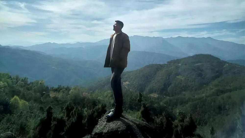
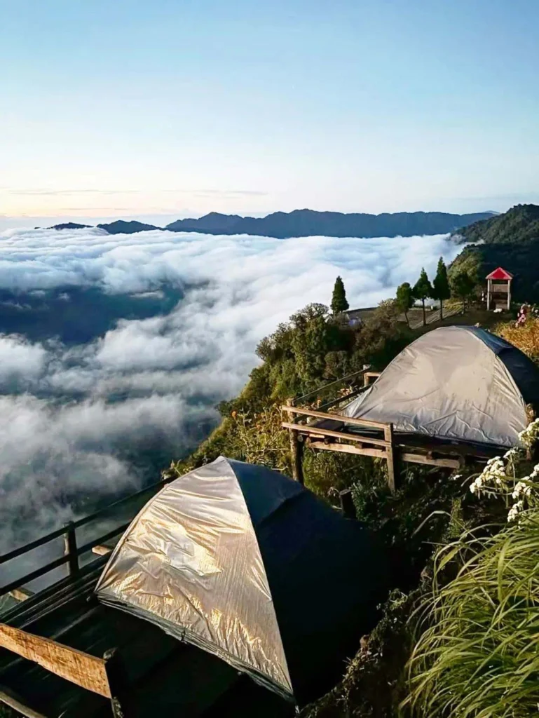
On a clear autumn morning, the summit of Mount Kapamodzü can feel like an island. The valleys of Phek district fill with cloud, ridgelines float above them in layers of blue, and the first light catches the far-off Saramati range on the Myanmar border. For a few minutes, the only sounds are the wind in the grass and the zip of a tent opening.
Kapamodzü (also spelt Kapamodzu or Kapamüdzü) is a broad, flat-topped peak about 2,620 m (8,596 ft) high, above the Chakhesang Naga village of Zhavame near Pfutsero. Nagaland Tourism describes it as the highest table-top mountain in the state. Over the past few years it has grown from a local secret into one of Nagaland’s best-loved camping spots, largely through word of mouth and social media.
This guide covers how to get there, what the camping is like, when to go, and how to visit responsibly.
Where is Mount Kapamodzü?
Mount Kapamodzü lies in Phek district, in the south-eastern hills of Nagaland, close to the border with Manipur. The peak falls within the lands of Zhavame village, whose community, together with its village council and students’ union, has been credited with looking after the site and conserving its forests.
The nearest town is Pfutsero, often described as the highest and coldest town in Nagaland at about 2,133 m (around 7,000 ft). The peak is roughly 16 km, or about 45 minutes by car, from Pfutsero, and about 80 km from Kohima.
Quick facts
| Detail | Information |
|---|---|
| State and district | Nagaland, Phek district |
| Village | Zhavame (Chakhesang Naga) |
| Altitude | About 2,620 m (8,596 ft) |
| Nearest town | Pfutsero, about 16 km |
| Distance from Kohima | About 80 km |
| Nearest airport and railway | Dimapur |
| Main activities | Camping, short hikes, sunrise and sunset viewing, stargazing |
| Entry fee | Rs 30 per person and Rs 50 per vehicle (reported in 2023; confirm on arrival) |
| Permit | Nagaland Inner Line Permit for non-resident Indian visitors |
| Best months | October to April for clear views; May to September for flowers and greenery |
Why visit Mount Kapamodzü?
Views across two states
The flat summit gives an unbroken panorama. On a clear day you can see the Saramati range to the east, home to Nagaland’s highest peak, Japfü peak to the south, the hills around Kohima, and villages scattered across both Nagaland and Manipur.
The sea of clouds
The experience most visitors come for is waking above the clouds. On cool, still mornings, especially after rain in autumn and early winter, mist settles in the valleys below the summit while the peak stays clear. Sunrise over this cloud sea, and sunset over the ridges, are the defining moments of a stay.
Night skies
With little artificial light nearby, the summit is a fine spot for stargazing. Visitors report seeing the Milky Way on clear, moonless nights.
Flowers and forest
The slopes support rhododendron, wild roses, trumpet flowers, ferns, holly, orchids and cane, according to Nagaland Tourism. In late summer and autumn, cosmos flowers spread across the hillsides around the peak and Pfutsero.
How to reach Mount Kapamodzü
Step 1: Reach Dimapur and Kohima
Dimapur has Nagaland’s airport and its main railway station, with connections to Guwahati, Kolkata and other cities. From Dimapur, shared taxis and buses run to Kohima, the state capital.
Step 2: Kohima to Pfutsero
Pfutsero is reached by road from Kohima. Distances quoted by travel guides range from about 50 to 70 km depending on the route, and the drive usually takes two to three and a half hours on winding hill roads. The common route runs via the NH 29 corridor through Kigwema and Jakhama; a second route via Chakabama has also been described as an option.
Without a private vehicle, take a Nagaland State Transport bus or a shared taxi from Kohima to Pfutsero, then hire a local car to Zhavame and the peak.
Step 3: Pfutsero to Zhavame and the summit
The final stretch from Pfutsero to Zhavame and up to the peak is the roughest part of the journey. Visitors describe it as bumpy and challenging, with potholes and broken surfaces. A high-clearance vehicle, ideally a four-wheel-drive, is the sensible choice, especially after rain. Many visitors hire a local driver in Pfutsero or arrange transport through their homestay.
Alternatively, fit walkers can hike part of the way. Treks from Pfutsero towards Kapamodzü are organised by local operators, and a group from the Nagaland Tourism Association marked World Tourism Day in September 2026 with a trek from Pfutsero’s “Peak of Hope” to Kapamodzü.
Approximate distances
| From | To Mount Kapamodzü | Typical travel time |
|---|---|---|
| Pfutsero | about 16 km | about 45 minutes |
| Kohima | about 80 km | about 3 to 4 hours |
| Dimapur | about 150 km (via Kohima) | 5 to 6 hours or more |
Distances are approximate; the Dimapur figure is an estimate based on the Kohima route, and actual times depend heavily on road conditions.
Camping at Kapamodzü
Camping is the heart of a visit. The summit has wooden platforms on which tents are pitched along the edge of the ridge, so most tents look straight out over the valleys.
- Tents and bedding: you can bring your own tent and sleeping bag, or rent them at the summit for a modest charge. Book ahead at weekends and in the peak season.
- Facilities: reports from 2023 mention a small glass-walled café and restaurant at the top, a modern toilet block, and log cabins under construction. Facilities may have changed since, so confirm when booking.
- Food: simple meals are available at the café; carry snacks and drinking water as a back-up.
- Bonfires: permitted in designated spots; follow the caretakers’ instructions.
Nights are cold for much of the year, and can fall close to or below freezing in winter. Pack thermal layers, a warm jacket, a hat, gloves, and a sleeping bag rated for low temperatures.
If you prefer a roof over your head, stay in a homestay in Zhavame and drive or walk up for sunrise, or base yourself in Pfutsero, which has lodges and guesthouses.
Best time to visit Mount Kapamodzü
Kapamodzü can be visited throughout the year, but each season offers something different.
| Season | Months | What to expect |
|---|---|---|
| Autumn | October to November | Clear skies, cloud seas in the valleys, cosmos flowers around Pfutsero; the most popular season |
| Winter | December to February | Cold, crisp days, frost in the mornings and very cold nights; long, clear views |
| Spring | March to April | Mild days, rhododendrons and wild flowers; haze can reduce long-distance views |
| Monsoon | May to September | Lush greenery and flowers, but frequent rain, cloud cover and slippery roads |
For the best chance of a sunrise above the clouds, aim for late October to early December. Pfutsero has also hosted an autumn cosmos festival in November, which can be combined with a visit.
Permits and practical information
- Inner Line Permit (ILP): Indian visitors who are not residents of Nagaland need an ILP. Applications are made online through the official portal (ilp.nagaland.gov.in); offline applications were discontinued at the end of 2024. A 2025 notification set the fee for a domestic tourist permit at Rs 200 for 30 days. Check current fees before you travel.
- Foreign nationals: foreign tourists also need to register through the ILP system and should check current requirements before travelling.
- Entry fee: a small community entry fee is collected for visitors and vehicles.
- Cash and connectivity: carry enough cash; ATMs and fuel are available in Pfutsero but not at the peak. Mobile signal varies.
- Health: the altitude is moderate and rarely causes serious problems, but take it easy if you arrive from the plains, drink water, and carry personal medicines. Basic health services are available in Zhavame and Pfutsero.
Travel tips for a better visit
- Arrive before sunset so you can pitch your tent and settle in while it is light.
- Set an alarm before dawn. The cloud sea is usually best in the first hour after sunrise.
- Avoid weekends in peak season if you want quiet; the site has become popular with visitors from Kohima.
- Keep to the platforms and paths. The ridge edge is steep in places, so take care, particularly with children and in the dark.
- Respect local customs. Nagaland is a largely Christian state, and Sunday is widely observed as a day of rest and worship; services may be limited.
- Carry your rubbish down. The site is maintained by the community, and its future depends on visitors keeping it clean.
Places to visit nearby
- Pfutsero Glory Peak: a viewpoint about 4 km from Pfutsero town, popular for sunrise.
- Khezhakeno village and Chida Lake: a historic Chakhesang village regarded as an ancestral home of several Naga tribes, with a hilltop lake nearby.
- Chizami: a Chakhesang village known for its weaving and community initiatives, on the road from Pfutsero to Phek.
- Kohima: the Kohima War Cemetery and Naga Heritage Village, which hosts the Hornbill Festival every December.
A sample two-day plan from Kohima
| Day | Plan |
|---|---|
| Day 1 | Morning drive from Kohima to Pfutsero; stop at Glory Peak; continue to Zhavame and the summit by mid-afternoon; sunset, dinner and stargazing; overnight in a tent |
| Day 2 | Sunrise above the clouds; breakfast at the summit; visit Khezhakeno or Chizami on the way back; return to Kohima by evening |
Frequently asked questions
How high is Mount Kapamodzü? About 2,620 m, or 8,596 ft, above sea level.
Is Kapamodzü the fourth-highest peak in Nagaland? It is often described that way, including by Nagaland Tourism and local media. However, more recent lists of Nagaland’s mountains include several higher peaks, so its exact ranking depends on the list used. It is consistently described as the state’s highest table-top mountain.
Can I drive to the top? Yes. The road from Pfutsero via Zhavame reaches the summit, but the last stretch is rough, and a high-clearance vehicle is strongly advisable.
Do I need to bring my own tent? No. Tents and sleeping bags can be rented at the summit, although bringing your own is allowed.
Is Kapamodzü suitable for families? Yes, for families comfortable with basic facilities and cold nights. Keep children away from the ridge edges.
Conclusion
Mount Kapamodzü offers one of the most rewarding short escapes in Nagaland. It combines easy access by Northeast Indian standards, a genuinely spectacular summit, and a community that has chosen to protect its mountain while welcoming visitors. A night under the stars and a sunrise above the clouds are well worth the bumpy drive from Pfutsero.
Go prepared for the cold, travel slowly through the Chakhesang villages on the way, and leave the mountain as you found it.
References
Official and government sources
- Nagaland Tourism – Hike to Kapamodzü Peak under Phek District (2020): itinerary, flora and views.
- Nagaland Tourism – The Majestic Kapamodzü and Zhavame Village
- DIPR Nagaland – Kapamodzu, Glory Peak and Chida Lake
- Nagaland Inner Line Permit portal: official ILP applications.
- DIPR Nagaland – Revised ILP guidelines (2025): domestic tourist fee and validity.
- NHIDCL – Unexplored beauty of Nagaland: Pfutsero–Phek highway and nearby attractions.
News reports
- The Morung Express – Kapamodzü peak emerging as a local tourist hotspot (November 2023): distances, facilities, visitor numbers, community conservation.
- Nagaland Tribune – Need a Break? Plan a Getaway to Kapamodzü (November 2023): entry fees, routes from Kohima, camping rentals.
- The Morung Express – NTA and NATO celebrate World Tourism Day 2026: Pfutsero to Kapamodzü trek.
- Eastern Mirror – ILP now online-only (June 2025)
Reference and travel sources
- Wikipedia – Kapamüdzü: altitude and coordinates.
- Wikipedia – Pfütsero: town details and cosmos festival.
- The Gypsy Chiring – Nagaland treks: Saramati, Japfü, Dzukou and Kapamodzu: first-hand trek notes.
- WanderOn – Pfutsero, Nagaland: Pfutsero altitude, Kohima distance, nearby places.