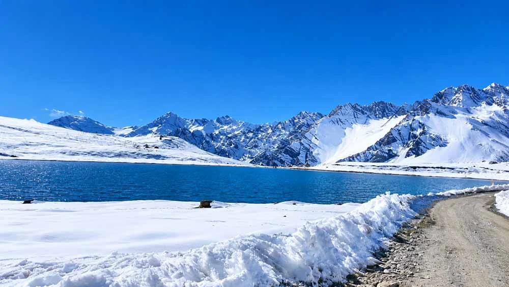
High above the yak-herding village of Mago, in the far eastern corner of Tawang district, a small alpine lake sits beneath a ring of snow-streaked ridges. For most of the year it receives no visitors at all. Gongkar La Lake lies close to the Gongkar La pass, which recent travel reports place at about 15,600 ft (roughly 4,750 m), on a rough mountain track that only opened to tourists in meaningful numbers over the last few years.
It is not a destination for a casual afternoon. Reaching it means a long drive from Tawang or Jang, an off-road climb beyond Mago, permits, and careful attention to altitude and weather. For travellers who prepare properly, however, it offers something increasingly rare in the Indian Himalaya: a high, quiet lake that has not yet been shaped by mass tourism.
This guide brings together what is currently known about the lake, the route, permits, seasons and safety, and is clear about what remains uncertain.
Where is Gongkar La Lake?
Gongkar La Lake is in the Mago–Chuna area of Thingbu circle, in the eastern part of Tawang district, western Arunachal Pradesh. This part of the district is high, thinly populated and close to the India–China border, which is why access is regulated.
The nearest settlement of any size is Mago, a Monpa village at about 3,585 m (11,762 ft) on the banks of the Goshu Chu. It lies roughly 85 km from Tawang town and 59 km from Jang. According to the 2011 Census, Mago had 486 residents in 75 households, most of whom depend on yak herding and move their animals to higher pastures in summer.
Beyond Mago, the road climbs towards Chuna, a high camp and army post in the Goshu Chu valley, and then up to Gongkar La. The lake sits on this upper stretch, close below the pass.
Quick facts
| Detail | Information |
|---|---|
| State and district | Arunachal Pradesh, Tawang district (Thingbu circle) |
| Nearest village | Mago (about 11,760 ft) |
| Approximate altitude | Pass about 15,600 ft; lake slightly below the pass (no official survey figure published) |
| Distance from Tawang | About 106–110 km by road to Gongkar La |
| Distance from Jang | About 80–83 km |
| Distance from Mago | About 20–22 km |
| Road type | Paved but narrow to Mago; off-road beyond Mago |
| Permit | Inner Line Permit for Indian visitors; further local clearance may apply in border areas |
| Best months | Late March to June, and September to November |
| Mobile network | Unreliable; do not depend on it |
Why travellers are drawn to Gongkar La Lake
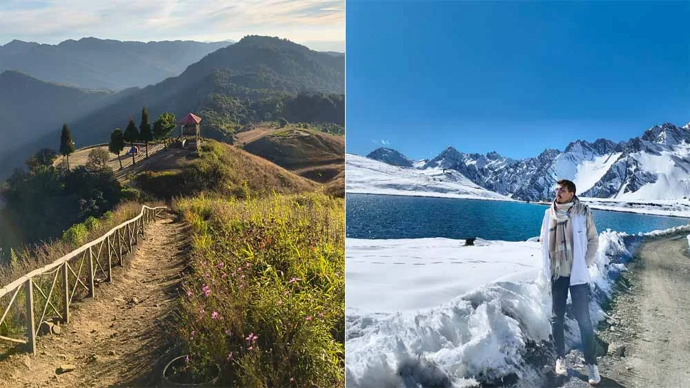
The appeal is the landscape itself. The final approach crosses bare, wind-scoured slopes above the tree line, where the only colours are rock, snow, sky and water. In clear weather the lake turns a deep blue against the white flanks of the surrounding ridges. In late winter and early spring it may still be frozen; a traveller who drove up in early March reported finding the surface completely iced over and the valley wrapped in fog.
The drive is part of the reward. The road from Jang to Mago follows the narrow gorge of the Mago Chu past waterfalls and the village of Thingbu. Mago itself is known locally for its hot springs, and the upper valley around Chuna opens into broad grassland framed by rugged peaks. Very few places in Northeast India allow an ordinary vehicle to climb this high.
How to reach Gongkar La Lake
Step 1: Reach Tawang or Jang
There is no airport in Tawang. Most travellers start from Guwahati (the main rail and air hub for the region) or Tezpur in Assam, and drive north through Bhalukpong, Bomdila, Dirang and over Sela Pass (about 13,700 ft) to Jang and Tawang.
For reference, one road-trip account recorded 389 km from Guwahati to Jang, covered in about ten and a half hours of driving with an early start. Most travellers break the journey at Dirang or Bomdila, which also helps with acclimatisation.
Step 2: Jang to Mago
Jang is the most practical base for the trip. Staying here rather than in Tawang avoids backtracking and allows an early start. From Jang, a newer road runs east through New Maling and Thingbu to Mago. It is surfaced but narrow, with frequent places to pull over. Drivers report that the first turn-offs out of Jang are not shown clearly on Google Maps, so ask locally before setting off.
Step 3: Mago to Chuna and Gongkar La
After Mago, the road becomes an off-road track. Expect loose stones, mud, stream crossings, steep gradients and fog. The final climb to Gongkar La is the hardest section: one driver described large stones on the surface and three consecutive uphill hairpin bends, where a small hatchback could not make the last bend.
Approximate distances
| From | To Mago | To Chuna | To Gongkar La |
|---|---|---|---|
| Tawang | about 85 km | about 97 km | about 106–110 km |
| Jang | about 59 km | about 71 km | about 80–83 km |
| Dirang | about 151 km | about 163 km | about 172 km |
These are approximate road distances compiled from travel guides; actual figures vary with diversions and road works.
Which vehicle should you use?
Use a high-clearance SUV, ideally a four-wheel-drive, with a driver experienced in mountain off-roading. Local taxis from Tawang or Jang are the safest option for most visitors, because local drivers know the route and the check-posts. Self-drivers should carry a spare tyre, a tyre inflator, basic tools and a tow rope. Experienced motorcyclists do ride this route, but riding two-up on the steepest sections is best avoided.
Engines lose power noticeably at this altitude. Drive slowly, especially on the descent, where stones can strike the underside of the vehicle.
Permits and regulations
Arunachal Pradesh is protected under the Inner Line regime, so every Indian visitor who is not a resident of the state needs an Inner Line Permit (ILP).
- Tourist eILP: apply online through the official portal at eilp.arunachal.gov.in. Travel guides that checked the portal in October 2026 report a fee of Rs 300 for stays of up to three days and Rs 500 for four to fourteen days. The tourist eILP allows a stay of up to 14 days.
- Border areas: an ILP does not automatically cover every road near the border. Check with the Deputy Commissioner’s office in Tawang or with your driver before you set out, and carry identity documents and permit copies for every check-post.
- Foreign nationals: foreigners need a Protected Area Permit (PAP) rather than an ILP. Access to sensitive border areas such as the Mago–Chuna road may be limited or refused, so confirm with a registered tour operator before planning.
- Photography and drones: do not photograph army installations, and do not fly drones without written permission.
Permit rules and fees change, so always confirm them on the official portal before you travel.
Best time to visit Gongkar La Lake
The weather around Tawang falls into four broad seasons, and each is felt more sharply at Gongkar La’s altitude.
| Season | Months | What to expect |
|---|---|---|
| Spring and early summer | March to June | Daytime temperatures around 10–20°C in the Tawang area, much colder at the lake; snow may linger and the lake may be frozen until spring |
| Monsoon | July to August | Rain, landslides and slippery tracks; generally not advisable |
| Autumn | September to November | Clear skies, dry roads and the best mountain views; the most reliable season |
| Winter | December to February | Heavy snow, sub-zero temperatures and possible closures; suitable only for well-equipped, experienced travellers with local support |
For a blue, unfrozen lake with clear views, late September to early November is the safest choice. If you want to see the lake framed by fresh snow, April to early June can be rewarding, though conditions are less predictable.
Whatever the month, start early. Weather at this altitude often changes after midday, and fog can reduce visibility to a few metres.
Where to stay
There are no hotels at the lake, and none are likely in the near future.
- Jang: the recommended base, with homestays and guesthouses and the shortest return drive.
- Mago: a handful of homestays and government guest rooms. Staying here allows a shorter, more relaxed visit to the lake, but facilities are basic and electricity and mobile coverage are unreliable.
- Tawang: the widest choice of hotels, but it adds considerable driving time.
Book ahead, carry cash, and expect simple food and shared facilities in Mago.
Altitude and safety: what every visitor should know
Gongkar La is higher than Sela Pass and comparable to some of Ladakh’s best-known passes. Respect the altitude.
- Acclimatise first. Spend at least one night at Tawang or Jang before going higher, and avoid driving straight up from the plains.
- Know the signs of altitude sickness. Headache, nausea, dizziness, breathlessness at rest and unusual tiredness are warning signs. If they worsen, descend at once.
- Keep the visit short. Spend a limited time at the lake and return to Mago or Jang to sleep.
- Dress for cold and wind. Carry thermal layers, a windproof jacket, gloves, a warm hat, sunglasses and sunscreen, even in summer.
- Carry supplies. Take water, snacks and any personal medicines. There are no shops or medical facilities beyond Mago.
- Travel with others. Avoid solo trips on this route, and tell someone your plans.
- Check advisories. In June 2026 the Tawang district administration issued a preparedness alert over a possible glacial lake outburst flood (GLOF) in the Mago Chu basin, after scientists reported expanding glacial lakes near the Khangri glacier. Officials said the immediate risk appeared limited, but visitors should check current district advisories before travelling, especially during the monsoon.
People with heart or lung conditions, pregnant travellers and families with very young children should consult a doctor before planning a trip to this altitude.
Responsible travel in a fragile landscape
The Mago–Chuna area is home to working Monpa communities and to fragile high-altitude meadows. The state government has begun planning eco-tourism and community-run tourism for the region, and local residents have raised concerns about power and mobile connectivity. Visitors can help this development stay sustainable.
- Carry all your waste back to Jang or Tawang.
- Do not drive off the track onto meadows or lake shores.
- Ask before photographing people, homes or religious sites.
- Respect yaks and herders; give animals space on the road.
- Use local homestays, drivers and guides, so that tourism income stays in the valley.
Places to combine with your trip
A visit to Gongkar La Lake fits naturally into a wider Tawang itinerary.
- Sela Pass and Sela Lake: the high pass on the main road to Tawang, often half-frozen in early spring.
- Jang (Nuranang) Falls: a powerful waterfall near Jang, worth a short stop.
- Mago hot springs: natural hot springs along the Goshu Chu, valued locally for bathing.
- Thingbu: a small Monpa village on the Jang–Mago road.
- Tawang Monastery: one of the largest Buddhist monasteries in India.
- Sangestar Tso (Madhuri Lake) and Bum La: reached from Tawang with separate permission.
- Zemithang and Gorsam Chorten: a quieter valley west of Tawang with a large stupa.
A sample four-day plan from Guwahati
| Day | Plan |
|---|---|
| Day 1 | Guwahati to Dirang (overnight; first acclimatisation stop) |
| Day 2 | Dirang to Jang via Sela Pass; short visit to Jang Falls |
| Day 3 | Early start: Jang to Mago, Chuna and Gongkar La Lake; return to Jang (or stay in Mago) |
| Day 4 | Jang to Tawang for the monastery, or begin the return journey |
Add a spare day for weather, road blockages or permit delays.
Frequently asked questions
How high is Gongkar La Lake? No official altitude for the lake has been published. Recent travel reports place Gongkar La pass at about 15,600 ft, with the lake a little below it.
Is Gongkar La Lake the highest lake in Northeast India? No. Some social media posts make this claim, but Gurudongmar Lake and Tso Lhamo in North Sikkim lie considerably higher.
Can I reach the lake by car? Yes, but only in a high-clearance vehicle, preferably a four-wheel-drive, with an experienced mountain driver. The route beyond Mago is off-road.
Do I need a special permit? Indian visitors need an Inner Line Permit. Because the area is close to the border, further local checks may apply; confirm with the Tawang district administration or your driver.
Can I do the trip in one day? From Jang, yes: travellers have made the return trip in a single long day. From Tawang it is a very long day, so staying in Jang or Mago is better.
Conclusion
Gongkar La Lake is one of the highest places in Arunachal Pradesh that ordinary visitors can now reach by road. Being so remote is part of its appeal, and also why the trip is hard. Allow time to acclimatise, travel with an experienced local driver, carry the right permits and go in a settled season, and you will find a quiet lake that few people have seen.
Carry your waste back down, stay on the track and leave the valley as you found it.
References
Official and government sources
- Tawang District Administration – Tourism: permits, seasons, Sela Pass and Bum La altitudes.
- Arunachal Pradesh Tourism – Arrival formalities: tourist eILP rules and 14-day limit.
- Arunachal Pradesh eILP portal: official permit applications and current fees.
- All India Radio Regional News, Itanagar (9 June 2026): GLOF preparedness in the Mago Chu basin.
News reports
- India Today NE – Tawang on alert over possible glacial lake flood threat (8 June 2026)
- Arunachal Times – Tawang on alert over threat of glacial lake outburst flood (9 June 2026)
- ThePrint (PTI) – Four of five glacial lakes in Arunachal basin expanded between 2016 and 2026
- Northeast Today – CM discusses eco-tourism plans for Mago–Chuna region
- Arunachal24 – Mago hosts tourism awareness meet
- EastMojo – CM reviews progress of Jang–Mago road (2022)
Reference and travel sources
- Wikipedia – Mago, Tawang: altitude, distances and 2011 Census figures.
- Team-BHP – Took my XUV 3XO to Gongkar La at 15,600 ft (April 2026): first-hand route and road conditions.
- TripHubGo – Mago Chuna and Gongkar La travel guide (October 2026): approximate distances and route stages.
- Discover with Dheeraj – Tawang travel guide 2026: tourist eILP fees as listed on the portal in October 2026.